Find out what's under a California property.
Search any address against California's oil and gas well database. See every well of record nearby, how far off the record may be, and what it doesn't tell you.
This searches the State of California's own oil and gas well database. That record is the best public source available, and it is incomplete and imprecise. Specifically:
- Recorded locations are often wrong. Most older wells were plotted from digitised maps rather than surveyed. A wellhead can sit hundreds of feet from where the state places it.
- Two thirds of plugged wells have no drill date on record. Where the state cannot say when a well was drilled, it cannot tell you which era's plugging standards were applied.
- Some wells appear in no record at all. California was drilled long before permitting existed. A result of zero is not evidence that no well exists.
- "Plugged" is a filing, not an inspection. It means an abandonment was reported. It says nothing about the casing, the cement, or the condition of that well today.
We report what the state record says, and we flag where that record is uncertain. Nothing here is an engineering opinion or a determination that any well was properly abandoned.
The free search reads the state file. The research package finds out what's actually there.
Everything above is a limitation of the government record, not of your property. Those limits are resolvable — but not from a database. It takes the original documents, historical imagery, and someone who knows how to read them.
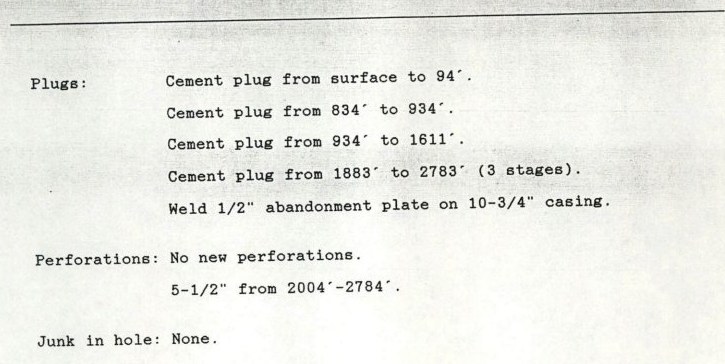
Four cement plugs at surface–94', 834'–934',
934'–1611' and 1883'–2783'. A welded plate on
the casing. Perforations left in place. This is the level of detail that exists in
the file and nowhere in the state's searchable database. Getting it takes knowing
which wells to request, which records to ask for, and how to read what comes back.
If nothing is there, you will know it. If something is, you will have the documents, the locations, and a clear set of next steps to protect yourself — before a buyer, a lender, or an inspector finds it first.
If you are not satisfied with the research we deliver, tell us and we refund the full amount. No forms, no arguing. We would rather lose the fee than have you feel you were sold something that did not help.
A note on limits. To keep this free and stop automated scraping, we allow one property search per visitor per day. If you need to run more — agents, inspectors, builders and attorneys often do — just reach out and we'll clear your account for higher volume at no charge.
Want this report emailed? COMPLETELY FREE
The full report includes the map, every well within a half mile, and a plain-English guide to what the record does and doesn't establish. Yours to forward to an agent, a lender, or an attorney.
On its way.
Check your inbox in the next minute or two. If it hasn't landed, look in spam and mark us as safe so future reports arrive.
Every one of these wells is still down there.
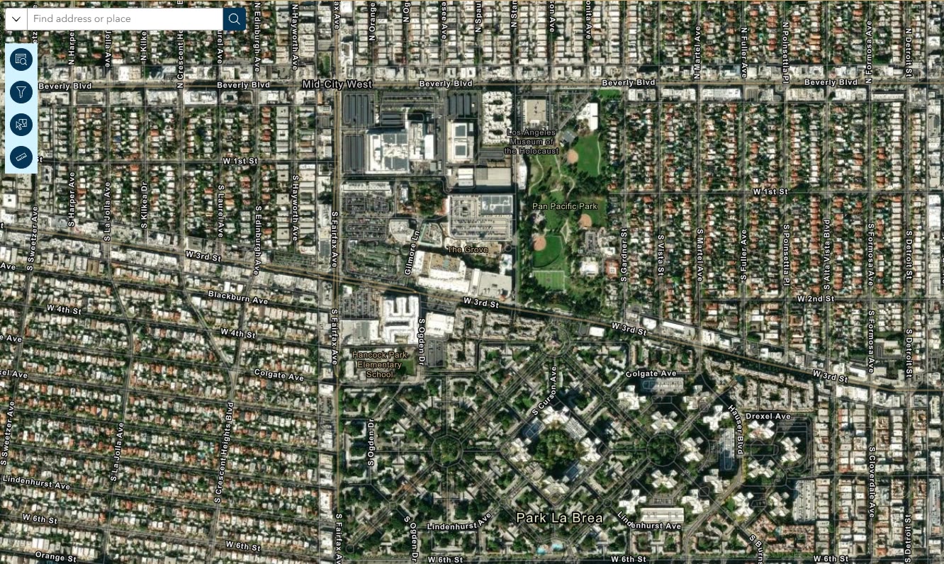
The derricks came down. The wells did not. Across California, tens of thousands of wells were sealed and built over — under houses, driveways, schools and apartment towers — using whatever the standard happened to be at the time, and often with no record of when they were drilled at all.
Historical and present-day aerial imagery · Los Angeles, California
Three steps, about ten seconds
Type the address
Any address in California. We resolve it to a location, then search from there.
We search the state well database
Every well of record within a half mile, measured from the property, with cancelled permits removed so you don't get false alarms.
Read the report
On screen immediately. Email it to yourself if you want a copy to forward to an agent, a lender or an attorney.
We'll show our work
We show you how to do it yourself
The whole free process is written up step by step, with screenshots. If you have more time than money, use that instead and pay us nothing.
Stated sources and dates
Every report says which dataset it used and when it was downloaded. No mystery methodology.
Not a government service
We are independent and not affiliated with CalGEM or any agency. The underlying data is public and we tell you how to get it.
We tell you when we don't know
Where the record can't answer a question, the report says so plainly instead of guessing.